Australian Resources Framework
Type of resources
Keywords
Publication year
Topics
-
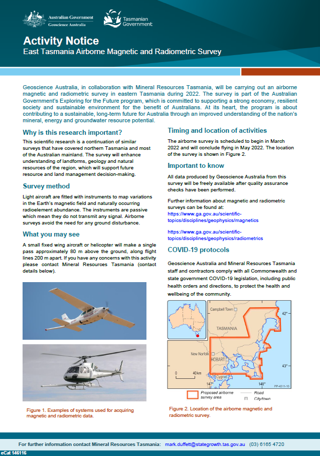
Geoscience Australia, in collaboration with Mineral Resources Tasmania, will be carrying out an airborne magnetic and radiometric survey in eastern Tasmania during 2022. The survey is part of the Australian Government’s Exploring for the Future program, which is committed to supporting a strong economy, resilient society and sustainable environment for the benefit of Australians. At its heart, the program is about contributing to a sustainable, long-term future for Australia through an improved understanding of the nation’s mineral, energy and groundwater resource potential. <p>
-
Geoscience Australia, in collaboration with state government agencies, has been collecting magnetotelluric (MT) data as part of the Australian Lithospheric Architecture Magnetotelluric Project (AusLAMP) for several years. This program aims to map the electrical resistivity of the rock layers, at depths from ten kilometres to hundreds of kilometres, across the entire continent. AusLAMP sites are each about 55 km apart from each other. Locations are chosen in consultation with landholders and other stakeholders to minimise impacts and avoid disturbance.MT data is collected using sensors that record naturally occurring variations of the Earth’s magnetic and electric fields. The equipment does not produce or transmit and signals. After four to six weeks the equipment is retrieved and the site restored to its original condition.
-
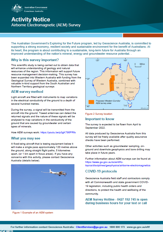
Geoscience Australia, in collaboration with state governments, will be carrying out airborne electromagnetic (AEM) surveys in western South Australia, southern NT and eastern WA during 2022. This scientific research is being carried out to obtain data that will enhance understanding of geology and natural resources of the region. This information will support future resource management decision-making. This survey has been expanded into Western Australia with funding from the Geological Survey of Western Australia, combined with valuable in-kind support from the South Australian and Northern Territory geological surveys. <p>
-
The AusArray program aims to install small temporary passive seismic stations every 200 km across Australia. The seismic stations will passively measure small natural vibrations that travel through the Earth to help scientists understand the distribution and composition of rocks beneath the ground. Seismometers are sensitive instruments used to measure small natural vibrations that travel through the Earth caused by earthquakes, waves breaking on the shore and even wind. The data collected are analysed to create a three-dimensional model of the Earth’s subsurface. Passive seismic data can be used to model the Earth‘s structure, which is used to infer the geological history and assess the resource potential and natural hazards of the region.
-
Survey Name: East Tasmania Datasets Acquired: Magnetics, Radiometrics and Elevation Geoscience Australia Project Number: P5020 Acquisition Start Date: 20/03/2022 Acquisition End Date: 23/06/2022 Flight line spacing: 200 m Flight line direction: East-West (090-270) Total distance flown: 57,709 line-km's Nominal terrain clearance: 80 m Data Acquisition: Magspec Airborne Surveys Pty Ltd Project Management: Geoscience Australia Quality Control: Geoscience Australia Dataset Ownership: Geoscience Australia and Mineral Resources Tasmania Datum: Geocentric Datum of Australia 2020 (GDA2020) Projection: Map Grid of Australia 55 (MGA55) Included in this release: 1. Point-located Data - ASCII-column (.dat) or NetCDF (.nc) format. • Magnetic diurnal; • Magnetics raw-edited; • Magnetics reduced; • Radiometrics raw-edited; • Radiometrics reduced. 2. Gridded data - ERMapper (.ers) format. • Total magnetic intensity (TMI); • TMI reduced to pole (RTP); • TMI RTP with first vertical derivative (1VD) applied; • Dose rate (with NASVD and standard processing); • Potassium concentration (with NASVD, standard processing); • Thorium concentration (with NASVD, standard processing); • Uranium concentration (with NASVD, standard processing); • Radar-derived digital elevation model (geoidal). 3. Reports. • Calibration report; • Operations and processing summary report. © Commonwealth of Australia (Geoscience Australia) and Mineral Resources Tasmania, Government of Tasmania 2022. With the exception of the Commonwealth Coat of Arms and where otherwise noted, this product is provided under a Creative Commons Attribution 4.0 International Licence (http://creativecommons.org/licenses/by/4.0/legalcode).